

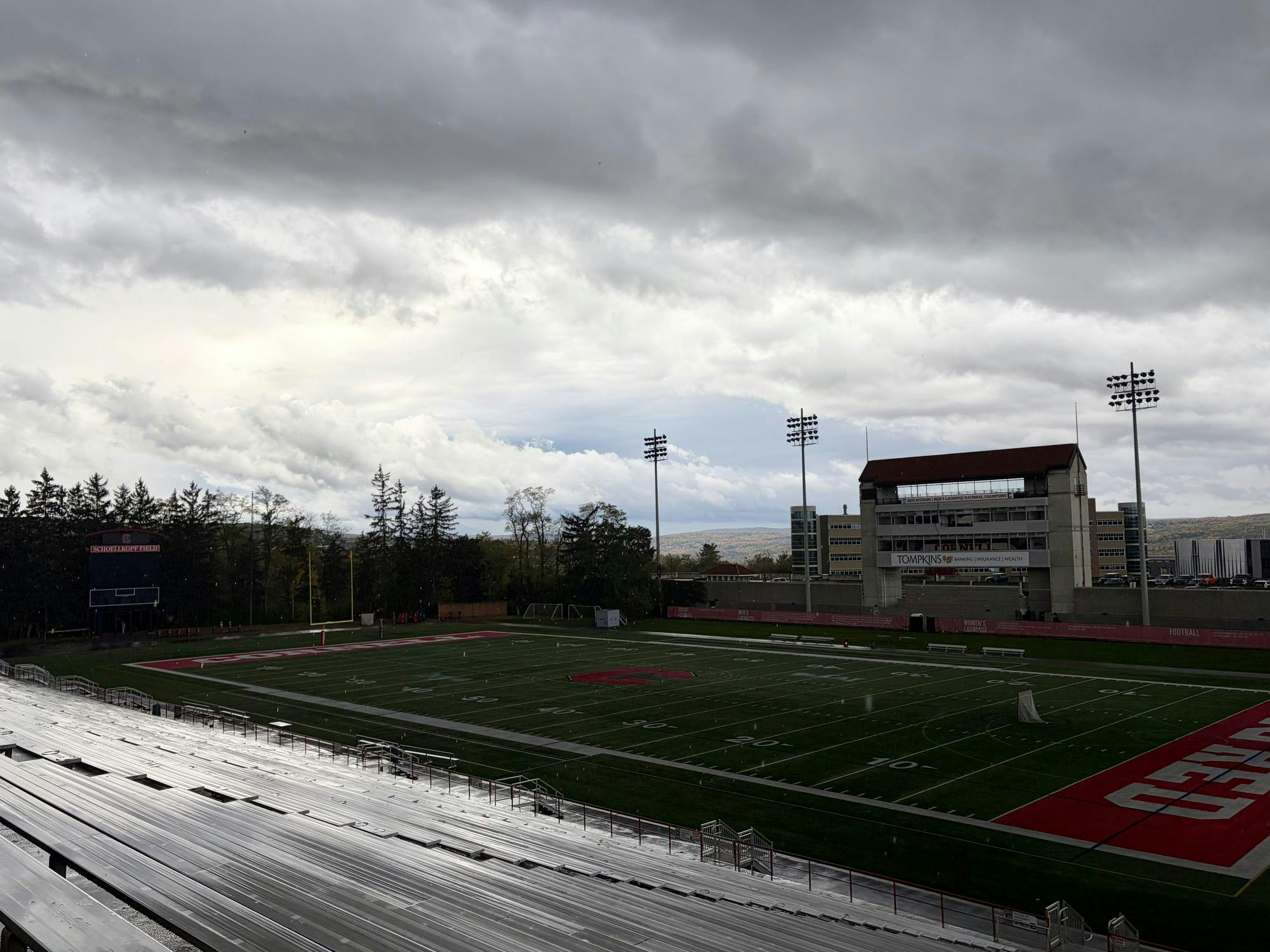
While Homecoming last year featured sunny skies and temperatures above 80 degrees Fahrenheit, this year may bring Cornell an early taste of winter weather.
Temperatures are forecasted to top out in the low 40s, and snow showers will be possible Saturday morning leading up to the 2 p.m. kickoff against Lehigh at Schoellkopf Field.
This will be the coldest Homecoming since 1993, which was also the last time a trace of snow was recorded during the event, The Sun found.
Gameday
On Saturday, Cornell will experience unseasonably cold temperatures in the mid- to upper 30s, persistent northwesterly winds of up to 20 miles per hour, and feels-like temperatures hovering near freezing for most of the day. Snow showers will be possible throughout the morning.
Lake-effect rain showers off of Lake Ontario and the Finger Lakes are likely to develop Friday night amid northwesterly flow behind the passage of a cold front, changing to snow showers at elevations above 800 feet by Saturday morning. Schoellkopf Field is located at an elevation of roughly 850 feet above sea level.
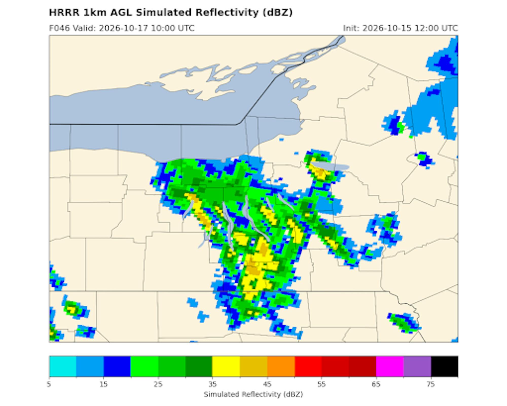
Temperatures will struggle to rise out of the 30s during the day even as snow showers come to an end and skies begin to clear Saturday afternoon. Sustained winds of up to 20 miles per hour and gusts as high as 30 miles per hour will cause it to feel even colder on exposed skin, with wind chill temperatures hovering near freezing for most of the day.
The National Weather Service in Binghamton forecasts a high temperature of 42 degrees on Saturday in Ithaca. If this forecast verifies, it will be the coldest Homecoming since 1993, when a high temperature of 40 degrees was measured and a trace of snow was recorded.
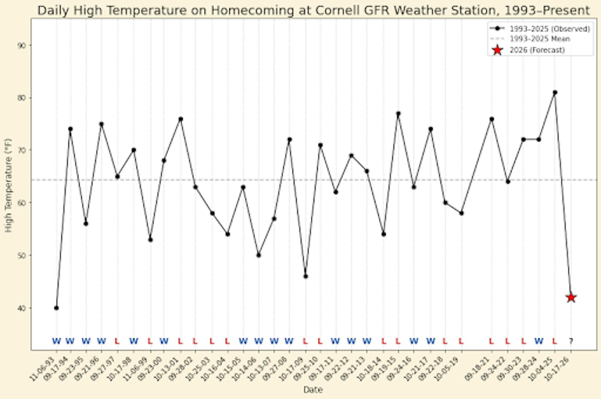
Last year’s high temperature of 81 degrees on Homecoming was the warmest on record dating back to at least 1993. The mean Homecoming high temperature between 1993 and 2025 was roughly 64.3 degrees, aligning with climatology for early October.
Homecoming generally falls between late September and mid-October, but has occurred as early as Sept. 17 in 1994 and 2011 and as late as Nov. 6 in 1993 and 1999.
Football is not the only varsity sport playing on Saturday. Women’s soccer kicks off against Princeton at 1 p.m. at Berman Field, women’s hockey takes on the University of Vermont in the second of a two-game series at Lynah Rink at 3 p.m. and men’s hockey opens its season with an exhibition game against the University of Waterloo at 7 p.m.
The latter two of these games take place indoors, and may be a good choice for those who are not fans of the cold.
Homecoming Weekend
On Friday, Cornell will experience temperatures in the upper 60s, high relative humidity, and intermittent showers and thunderstorms.
A low-pressure system will tracks through the St. Lawrence Valley north of Ithaca on the leading edge of an upper-level trough, or area of low pressure in the upper atmosphere. In the system’s warm sector, southerly flow moves warm air into the Finger Lakes region, allowing temperatures to potentially rise as high as 70 degrees.
Showers will be likely throughout the day on Friday, with enough instability developing by early afternoon for even a possibility of thunderstorms.
Behind the bulk of the synoptic precipitation — the precipitation directly associated with the low pressure — a cold front moves through late Friday afternoon. Winds will turn northwesterly behind the front, and temperatures will plummet into the 30s by Saturday morning.
Saturday night, high pressure moving in from the southwest will lead to clearing skies and falling winds, likely allowing temperatures to fall into the 20s by Sunday morning and resulting in the first widespread freeze of the season across the Finger Lakes region. Southwesterly flow will advect warm air back into the region during the day Sunday, and temperatures are expected to rebound into the upper 50s by the afternoon.
A warming trend continues into next week as upper-level ridging establishes itself over the eastern U.S., with above-normal temperatures and generally dry conditions likely to persist through next weekend.
Jihan Bhuiyan is a member of the Class of 2029 studying atmospheric science in the College of Agriculture and Life Science. He is a contributor for the science and technology department and can be reached at jsb469@cornell.edu.


